Down the Columbia
The captains also met the unexpected in the people they encountered on their descent of the Columbia. In mid-October, as Clark recorded in his journal, the Corps paused at the mouth of the Snake River, where “we met our 2 Chiefs who left us two days ago and proceeded on to this place to inform those bands of our approach and friendly intentions towards all nations &c.” As Lewis and Clark came across village groups, they brought the same message to headmen on the Columbia that they had on the Missouri—make alliance with Americans, participate in trade, and live in peace.
The promise of manufactured goods, especially firearms, brought interest from Native groups who were vulnerable to attacks from more powerful groups in the region. Yelleppit of the Wallula, for example, visited the Corps just downstream from the Snake and joined in a council, where he requested that Lewis and Clark spend an additional day to firm up good relations. Yelleppit’s reasons for solicitation, according to historian James Ronda, were clear: “The chief had his eye on the weapons and goods carried by the explorers.” Yelleppit wanted a promise of trade in weapons, which he got from the captains and later reaffirmed, when the Corps spent two days in his camp on their return from the Pacific Coast in 1806.
Where the Columbia cut through the basalt plateau east of the Cascade Mountains, the water ran through narrow channels and fell over sharp drops that created ideal places to snag, net, and gaff salmon that ran up the great river each year in the millions. “No other place on the Columbia could support so many people together,” trader Alexander Ross later described the Long Narrows on the river, where the channel narrowed to a less than one hundred yards. The runs began in spring and peaked in late summer, not long before Lewis and Clark drifted downstream in 1805.
They had just missed the last of the fishing seasons, but they did not avoid contact with Indians who managed the fishing sites and travel on the river. Not unlike the Teton Sioux on the Missouri, the Chinookan-speaking groups at The Dalles of the Columbia were determined to control activity on the river, and that meant tough bargaining with the Corps of Discovery.
The fish runs each year brought thousands of Indians to the place, where trading, games, and social life whirled around the great richness in fresh, dried, and pounded salmon that sustained Columbia River Indians and provided trading commodities. Lewis and Clark had entered a new part of the river, where Sahaptian and Chinookan people lived side by side, and where trading and access to fishing places created a contested landscape.
Indian trading behavior baffled and angered the explorers. Indians were “troublesome about our Camp,” Joseph Whitehouse noted in his journal. Clark worried more about theft than safety. After portaging around the treacherous passage, Clark noted: “I had formed a camp on ellegable Situation for the protection of our Stores from Thieft, which we were more fearfull of, than their arrows.” Lewis and Clark judged the Indians’ request for portage duties as "theft," and they misunderstood the Indians’ assumption that all useful items entered into exchanges. The explorers demanded a controlled trading exchange. To them, the freely grabbing Indian traders were thieves.
The Nez Perce guides, Twisted Hair and Teotarsky, injected more concern, warning the captains that Indians below the falls—Chinookans who spoke a much different language—planned to attack the Corps and would destroy them. The guides announced they would decamp and head back, but Lewis and Clark pleaded with them to stay with the Corps and “see the nation below and make peace between them.” The two Nez Perce bent to their wishes. “The principal Chief from the nation below with Several of his men visited us,” Clark recorded on October 24, “and afforded a favourable opportunity of bringing about a Piece.”
The Nez Perce headed back upriver, while the captains congratulated themselves on their successful diplomacy and pointed their canoes into Chinookan territory, the river’s damp estuarial zone, where they fought bad weather and rough water for three additional weeks before making the coast.
© William L. Lang, 2004. Updated and revised by OHP staff, 2014.
Sections
Related Historical Records
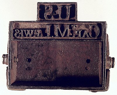
Captain Meriwether Lewis's Branding Iron
Captain Meriwether Lewis carried this branding iron on the Corps of Discovery’s 1804–1806 exploration of western North America (the captains also carried a smaller "stirrup iron" used to …
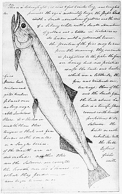
Clark's Drawing of White Salmon Trout
This is a copy of a sketch made by William Clark in February 1806, while Expedition members were at Fort Clatsop near the mouth of the Columbia River. …
Estimate of Western Indians, Lewis and Clark Journals
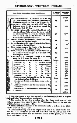
Charged by Pres. Thomas Jefferson with recording the names of Native communities and estimating the size of their populations, Captains Meriwether Lewis and William Clark took note of …
