- Catalog No. —
- OHS Map 238
- Date —
- 1912
- Era —
- 1881-1920 (Industrialization and Progressive Reform)
- Themes —
- Environment and Natural Resources, Government, Law, and Politics, Oregon Trail and Resettlement, Trade, Business, Industry, and the Economy
- Credits —
- Oregon Historical Society
- Regions —
- Oregon Country Southwest
- Author —
- U.S. Geological Survey
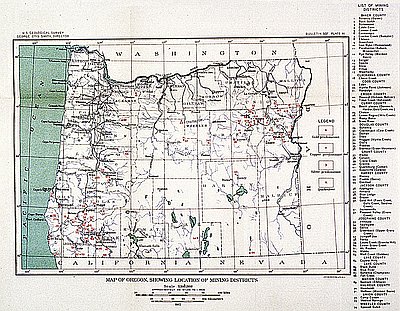
Oregon Mining Districts
The U.S. Geological Survey (USGS) made this 1912 map. Between 1907 and 1930, George Otis Smith was the director of the USGS, an agency created in 1879 to classify federal lands and study their geology and mineral resources.
In the early 1850s, prospectors first discovered gold in the southern region of what was then Oregon Territory. In the 1860s, gold miners moved into eastern Oregon. In both areas, corporations with outside investors soon replaced small and independent mining operations. Workers used gravity-fed, high-pressure water to remove entire hillsides, drastically altering landscapes and destroying fish habitat in streams and rivers. They also tunneled underground for gold, silver, and copper.
In Oregon, miners also found mercury, then called quicksilver. Mercury was one of several toxic chemicals, including chlorine and arsenic, that companies used to extract minerals from rock and dirt. Today, scientists have found high levels of mercury and arsenic from historic mining operations in some of Oregon’s waterways, including Cottage Grove Lake and Dorena Reservoir.
In 2000, the U.S. Census Bureau reported that 2,479 people worked in mining in Oregon.
Written by Kathy Tucker, © Oregon Historical Society, 2002.
Related Historical Records
-
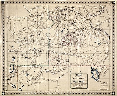
Mining Sections of Idaho and Oregon, 1864
This 1864 map of the mining sections of Idaho and eastern Oregon was drawn by George Woodman and published by San Francisco bookseller Adrien Gensoul. The map was …

-
Mining, Lumbering, and Shipbuilding
The southern Oregon Coast between Coos Bay and Gold Beach experienced an early and mostly unproductive mid nineteenth-century gold rush, which gave Gold Beach its name. The gold …
-
Oregon Mining Districts
The U.S. Geological Survey (USGS) made this 1912 map. Between 1907 and 1930, George Otis Smith was the director of the USGS, an agency created in 1879 to …

