855 results
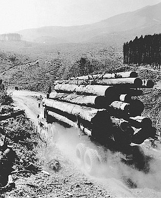
Log Truck Stirs Dust through Clearcut
This undated photograph from the Timberman is identified as being from the Pacific Northwest. Although the title accompanying the photograph in the collection identifies the …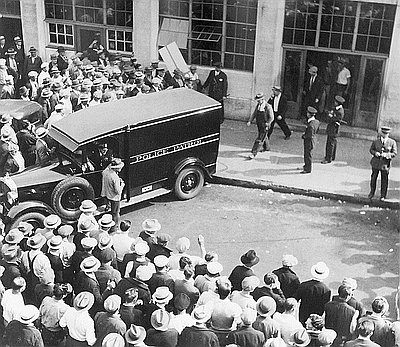
Longshoremen's Strike of 1934
This photograph of the 1934 waterfront strike shows Portland police escorting “scabs” through picket lines outside a hiring hall, a building used by companies to …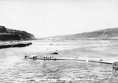
Looking Downstream to Celilo
This undated photograph shows non-Indians fishing for salmon along the free-flowing and meandering Columbia River just upriver from Celilo Falls. Writing on the photograph indicates …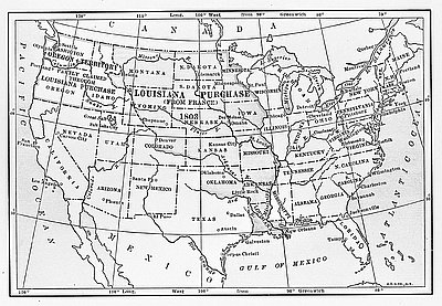
Louisiana Purchase
This map was published in a 1911 book titled Louisiana Under the Rule of Spain, France, and the United States. Maps like this appear …
Lower Columbia Fisheries Plan
In 1949, the U.S. Army Corps of Engineers included this map as a representation of the Lower Columbia River Fisheries Development Program in a “review …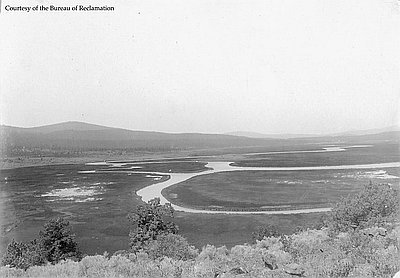
Lower Klamath Marshes
The Klamath Basin National Wildlife Refuge complex includes the Upper Klamath, Klamath Marsh, and Bear Valley Refuges in Oregon and the Lower Klamath, Tule Lake, …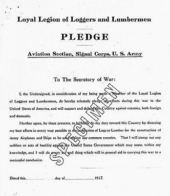
Loyal Legion of Loggers & Lumbermen Pledge
This “specimen” of the “Four-L Pledge” was originally devised under the leadership of the U.S. War Department’s Col. Brice P. Disque as part of a …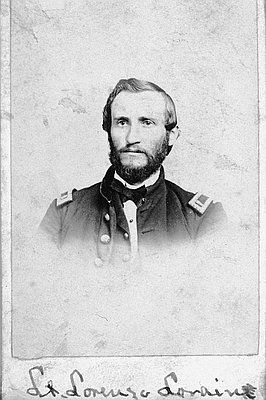
Lt. Lorenzo Lorain
This photograph of Lieutenant Lorenzo Lorain was likely taken by Lorain’s colleague at Fort Umpqua, fort surgeon Dr. Edward Perry Vollum. Both Vollum and Lorain …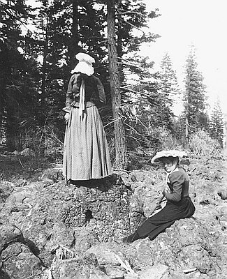
Lula Schminck & Florence Klippel on Lava Beds
This photograph, from the collections of the Schminck Memorial Museum, was taken in April 1900. It shows sisters Lula Schminck and Florence Klippel on a …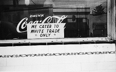
Luncheonette Sign, We Cater to White Trade Only
Signs similar to this one in the window of the Denver Cafe, across the street from the Kenton Theatre in north Portland, popped up during …Interpretive Essays
Interpretive essays use primary documents from the Oregon Historical Society archives to help readers imagine the events, people, and issues that shaped Oregon history.