855 results
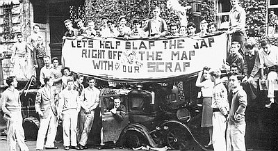
Lincoln High Scrap Metal Drive, 1942
This photograph appeared in the Oregon Journal on October 11, 1942, along with other photographs celebrating the efforts of local schools and organizations taking part …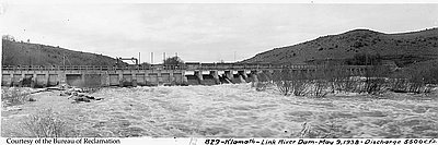
Link River Dam, 1938
The Link River runs through Klamath Falls and connects Upper Klamath Lake with Lake Ewauna. One of the nation’s shortest rivers, the Link River was …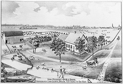
Linn County Farm of Dr. H.A. Davis
This image of an 1878 engraving found in Historical Atlas Map of Marion and Linn Counties, Oregon shows the property of Dr. Henry A. Davis …
Linn County Promotional Brochure
This image shows the front and back covers of a promotional pamphlet published by the Commerce Committee of Albany about 1902. When this pamphlet was …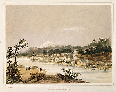
Lithograph, American Village
This hand-colored lithograph print is based on a watercolor and pencil sketch by Henry J. Warre. It was one of a series of prints included …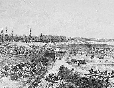
Lithograph of Fort Vancouver
This 1854 lithograph of Fort Vancouver was originally drawn by Gustavus Sohon while he and the U.S. Pacific Railroad Expedition and Survey team conducted a …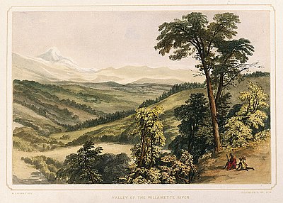
Lithograph, Valley of the Willamette River
This hand-colored lithograph print is based on a watercolor and pencil sketch by Henry J. Warre. It was one of a series of prints included …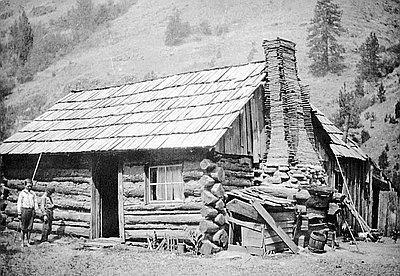
Log Cabin near Bingham Springs
This weathered cabin, perhaps built in the 1870s, was located near Bingham Springs in eastern Umatilla County. The photograph is one of a series of …
Logged-off Land near Neahkahnie Mountain, 1968
Al Monner took this 1968 photograph of clear-cut logging near Neahkahnie Mountain, located in northwest Tillamook County. Monner, who died in 1998, was a photographer …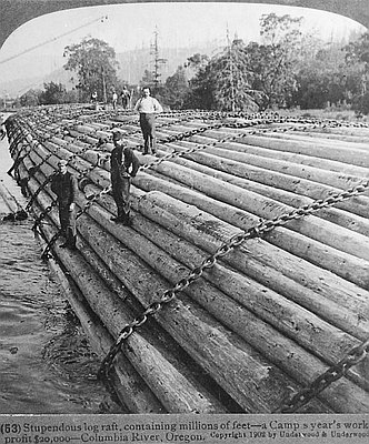
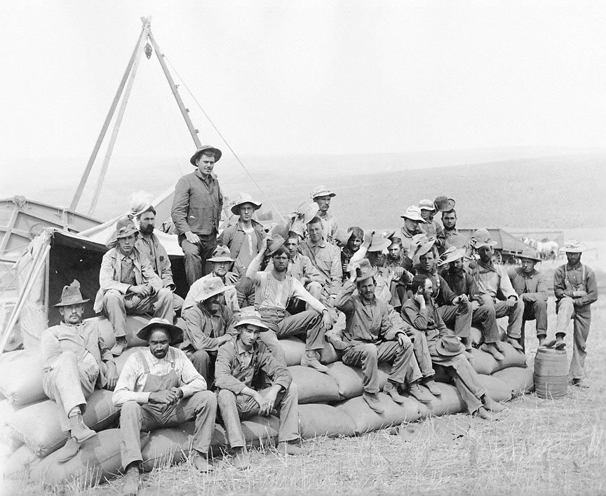
Log Rafts, 1902
This photograph of men posing atop a “Benson raft” was originally sold as a stereograph by Underwood & Underwood, a stereographic distributing company, established in …Interpretive Essays
Interpretive essays use primary documents from the Oregon Historical Society archives to help readers imagine the events, people, and issues that shaped Oregon history.