137 results
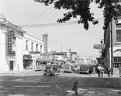
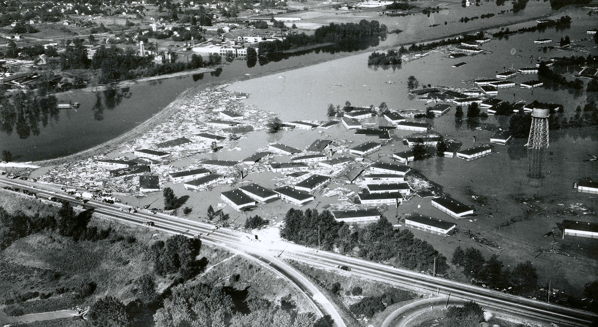
Klamath Falls, 1941
In 1860, the Federal Government granted the states swamplands, and by 1867, Oregon opened these lands to settlers. That same year, “swampgrabber” George Nurse secured …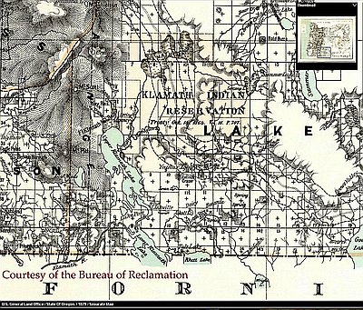
Klamath Indian Reservation
When white explorers entered the Klamath Basin in the 1820s, the Klamath Indians occupied the Upper Klamath Lake area, which included Klamath Marsh and the …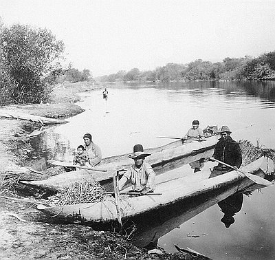
Klamath Indians in Dugout Canoes
The Klamath Indians traditionally lived in villages and seasonal camps in southern Oregon, near upper Klamath Lake, Klamath Marsh, and the lower Williamson River. Canoes …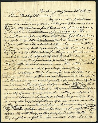
Letter from Samuel R. Thurston to Wesley Shannon, June 22, 1850, regarding Oregon's Black exclusion laws
Click here for full letter. Click here for transcript. This letter was written by Territorial Representative Samuel Thurston in 1850 to his friend and …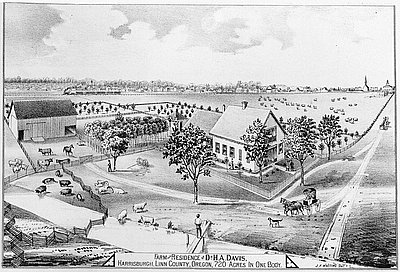
Linn County Farm of Dr. H.A. Davis
This image of an 1878 engraving found in Historical Atlas Map of Marion and Linn Counties, Oregon shows the property of Dr. Henry A. Davis …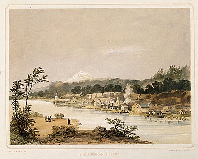
Lithograph, American Village
This hand-colored lithograph print is based on a watercolor and pencil sketch by Henry J. Warre. It was one of a series of prints included …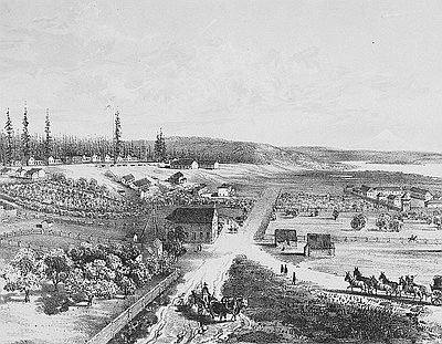
Lithograph of Fort Vancouver
This 1854 lithograph of Fort Vancouver was originally drawn by Gustavus Sohon while he and the U.S. Pacific Railroad Expedition and Survey team conducted a …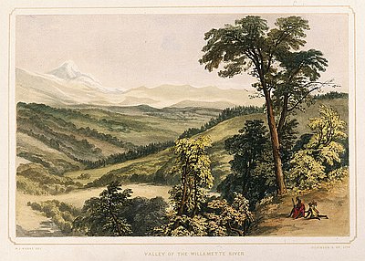
Lithograph, Valley of the Willamette River
This hand-colored lithograph print is based on a watercolor and pencil sketch by Henry J. Warre. It was one of a series of prints included …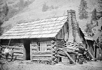
Log Cabin near Bingham Springs
This weathered cabin, perhaps built in the 1870s, was located near Bingham Springs in eastern Umatilla County. The photograph is one of a series of …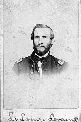
Lt. Lorenzo Lorain
This photograph of Lieutenant Lorenzo Lorain was likely taken by Lorain’s colleague at Fort Umpqua, fort surgeon Dr. Edward Perry Vollum. Both Vollum and Lorain …Interpretive Essays
Interpretive essays use primary documents from the Oregon Historical Society archives to help readers imagine the events, people, and issues that shaped Oregon history.