- Catalog No. —
- OHS Map 112
- Date —
- 1892
- Era —
- 1881-1920 (Industrialization and Progressive Reform)
- Themes —
- Geography and Places
- Credits —
- Oregon Historical Society
- Regions —
- Southeast
- Author —
- Lt. Thomas W. Symons and Alfred Downing
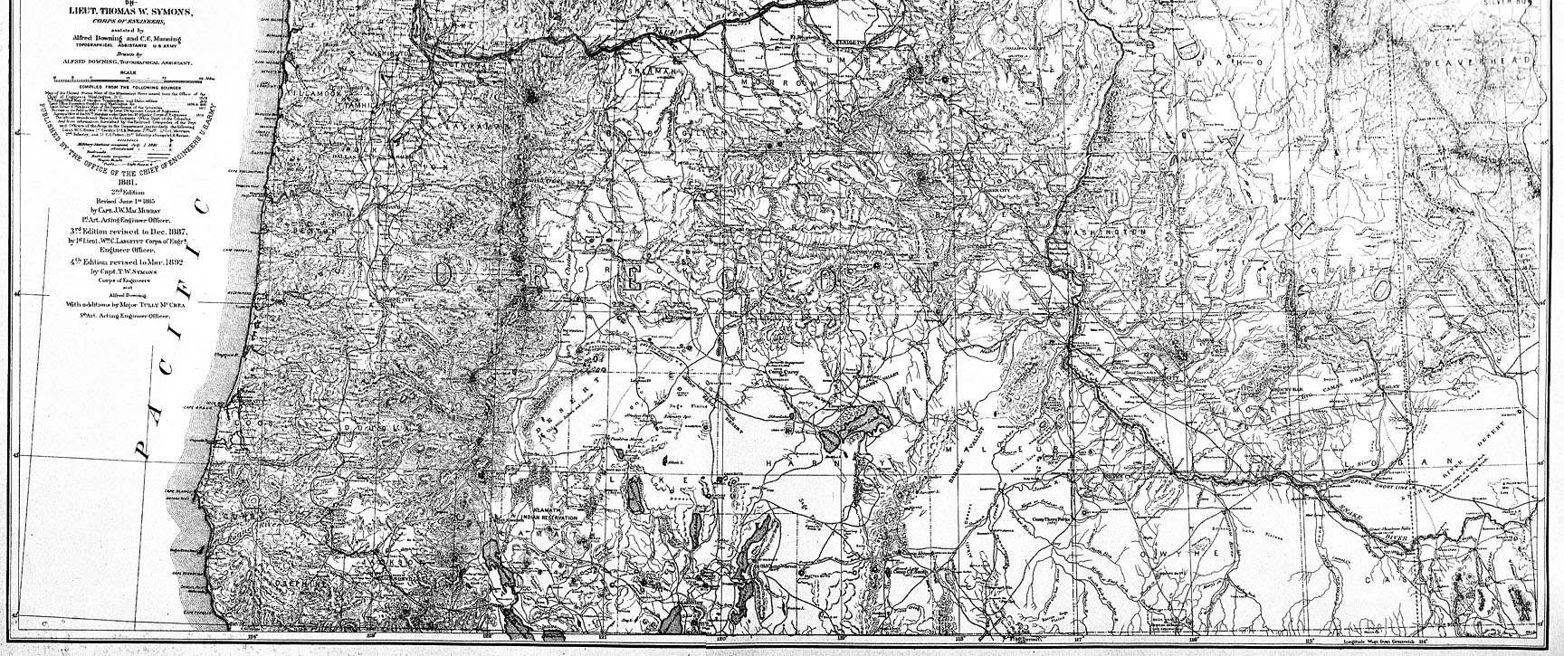
The Department of the Columbia, 1892
This map detail of southeastern Oregon comes from an 1892 map of Oregon, Washington, and Idaho titled “Map of the Department of the Columbia.” The map was projected and compiled by Lieutenant Thomas W. Symons and drawn by Alfred Downing, both of whom worked for the U.S. Army Corps of Engineers.
Maps like this one represent the cumulative knowledge of generations of cartographers. This particular map, for example, is the fourth edition of a map originally drawn in 1879, a map that was in turn based on maps going back a century or more. Unlike many maps, the map from which the detail above was taken cites the sources that the cartographers consulted when drawing it. Four other maps are cited, two Corps of Engineers maps and two General Land Office maps. The cartographers also cite field surveys conducted by railroad companies and by the U.S. Army.
The U.S. Army and other branches of the federal government played a key role in the mapping of the American West. The Lewis and Clark Expedition made the first federally sponsored maps of the West in 1805 and 1806, though parts of the region remained largely unmapped for several more decades, including southeastern Oregon. The General Land Office began making maps of the entire state of Oregon in the early 1850s, but their depictions of the southeastern section of the state were largely speculatory. It was known that the area had a number of large lakes, but the location and size of these bodies of water were not known precisely. Mountain ranges on mid-century maps of southeastern Oregon also tend to vary wildly from their actual location. Some maps from this period, for example, show the Blue Mountains extending south through present-day Harney County into California.
As the century progressed, however, so did geographical knowledge about the southeastern corner of the state, due in large part to federal mapping efforts. In 1859, a major U.S. Army expedition led by Captain Henry D. Wallen mapped portions of present-day Harney and Malheur counties. The General Land Office also began surveying townships around lakes and along roads in southeastern Oregon during the 1860s, producing highly detailed and accurate maps.
By the 1890s, federal cartographers were producing beautifully drawn and geographically accurate maps of the entire Pacific Northwest region, including southeastern Oregon. Regional reference maps like the one from which the detail above was taken would have been used primarily to plan water resource management projects, particularly navigation improvements.
Further Reading:
Cohen, Paul. Mapping the West: America’s Westward Movement 1524-1890. New York, N.Y., 2002.
Written by Cain Allen, © Oregon Historical Society, 2005