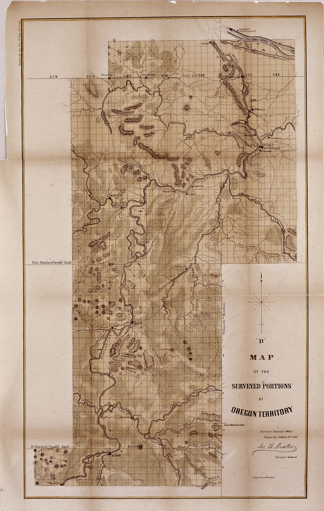
The map above shows the surveyed portion of the Oregon Territory as of October 21, 1852. It was prepared by John B. Preston, first surveyor general of Oregon.
With the establishment of the Oregon Territory on August 14, 1848, all grants of claims of land in the territory were nullified. It was not until the passage of the Donation Land Act on September 27, 1850, that new provisions were made for acquiring unclaimed land, to be based upon government surveys. John B. Preston was appointed first surveyor general of Oregon, where he arrived on April 20, 1851. On June 7, 1851, Preston drove the “starting stake” for the base surveys of the territory at what is today known as the Willamette Stone. The east-west Willamette Base Line and the north-south Willamette Meridian still define surveying and legal land descriptions in Oregon and Washington state.
Preston and his crew were able to carry out their surveying and mapping to the extent depicted on this map in just over one year. Each square of the grid, termed a section, is one mile on each side and includes 640 acres of land—the maximum acreage allowed for a married couple making a claim under the Donation Land Act; a single man could claim up to 320 acres. Thirty-six sections make up a township.
The surveyors took careful note of waterways, hills, prairies, and roads. Some recognizable places are already viable communities, such as Salem and Lafayette; other communities of the period—Champoeg, Fairfield, Cincinnati, for example—have vanished as meaningful places. All three of those were river landings that were affected by floods, channel changes, and the eventual disappearance of river transportation. Notably absent from the map is Mission Bottom or Mission Landing, the by-then-abandoned site of the Methodist mission of the 1830s, and St. Paul on French Prairie. The roads that are mapped include ancient routes such as the California-Oregon Trail, which had sections that paralleled both sides of the valley, as well as newer roads established in recent years. The roads converging on Salem from the outlying farming districts, for instance, reflect its recent importance as a mill town, powered by the waters of Mill Creek.
Further Reading:
Bowen, William A. The Willamette Valley: Migration and Settlement on the Oregon Frontier. Seattle, Wash., 1978.
Corning, Howard McKinley. Willamette Landings. Portland, Oreg., 2004.
Written by Richard Engeman, © Oregon Historical Society, 2005.