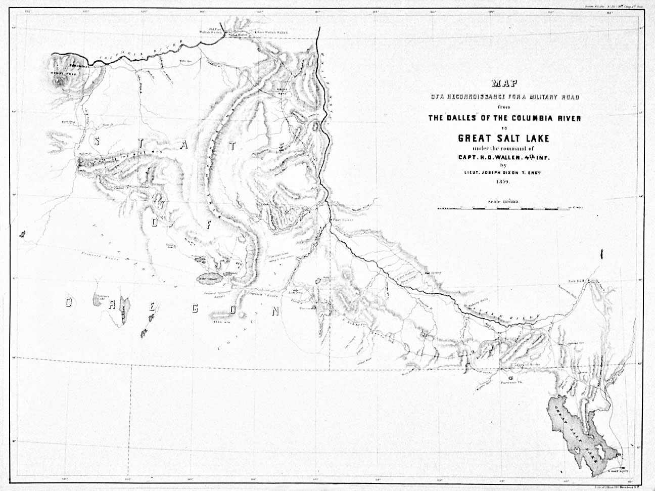
This map charts the western portion of the Oregon Trail as well as the route of the 1859 Wallen expedition, which explored eastern Oregon in search of an all-season road from The Dalles to Salt Lake. It was drawn by U.S. Army topographical engineer Lt. Joseph Dixon in 1859.
During the 1840s and 1850s, tens of thousands of emigrants traveled across the Oregon Trail on their way to western Oregon and Washington. Most of them followed a route along the Snake River before heading northwest towards the Grande Ronde Valley. From there the trail went across the Blue Mountains to the Umatilla Valley, then west towards The Dalles. From The Dalles emigrants faced the choice of either following the Barlow Road across the Cascades or taking the water route down the Columbia River to the Willamette Valley. Most chose the Barlow Road, though winter weather forced many to take the more dangerous river route.
The portion of the Oregon Trail that crossed the Blue Mountains was generally inaccessible during the winter months, limiting transportation for a significant portion of the year. The Indian wars of the late 1850s led General William S. Harney, commander of the U.S. Army’s Oregon Department, to recommend the establishment of an all-season supply route from Salt Lake to the Columbia River in order to speed troop movement and to secure the emigrant route.
At the end of April 1859, Harney ordered Captain Henry D. Wallen to “open a road from the Dalles to the Great Salt Lake valley.” The Wallen expedition left Ft. Dalles on June 4, 1859, following an established trail southward along the Deschutes River before heading east, roughly following the route of present-day Highway 26 from Madras to Prineville. A small party explored the John Day country while the rest of the expedition headed up the Crooked River towards present-day Paulina, then across the mountains to Harney Valley. From there they went down the Malheur River towards old Fort Boise, near which they linked up with the established Oregon Trail.
The routes explored by the Wallen expedition turned out to be unsuitable for wagon travel, but as evidenced by the map reproduced above, the expedition did succeed in gaining a significant amount of geographical knowledge about a little known portion of Oregon’s interior.
Further Reading:
Menefee, Leah Collins and Lowell Tiller. “Cutoff Fever, VI.” Oregon Historical Quarterly 79, 1978: 5-50.
Willingham, William F. Army Engineers and the Development of Oregon: A History of the Portland District, U.S. Army Corps of Engineers. Portland, Oreg., 1983.
Written by Cain Allen, © Oregon Historical Society, 2005.