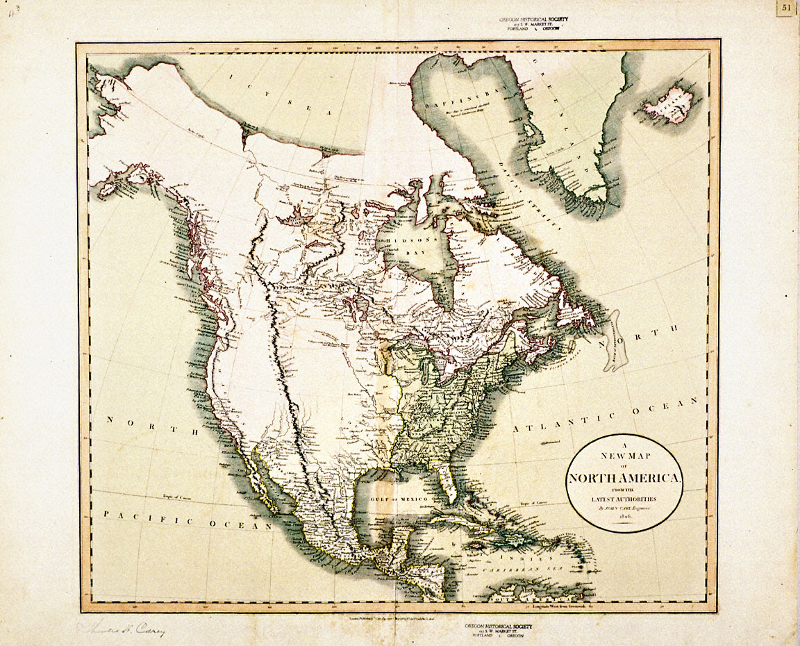
John Cary (1754-1835) produced this map of North America in 1806. Cary, a London-based engraver, was one of the most influential mapmakers and publishers of his time. He is best known for producing several detailed atlases of England.
Cary’s map reveals the state of European and American geographical knowledge of North America at the time of the Lewis and Clark Expedition. While Mexico and the eastern portion of the continent are mapped in detail, large portions of the interior are left blank. Most of the Pacific Northwest is uncharted, though the coastline is accurate and fairly detailed thanks to the discoveries of James Cook, George Vancouver, and other maritime explorers.
Among the most striking geographic features of this map are the Rocky Mountains. While it was an accepted fact in the early 1800s that a range of mountains divided the continent, the precise contours of the range were unknown. Some Americans and Europeans held the theory that the Rockies were a single ridge that spanned the continent from north to south. This view of the continental divide is expressed here in Cary’s map.
Others believed that most of the continent’s major river systems originated at a pyramidal “height of land” or plateau at the center of the continent which separated mountain ranges to the north and south. According to this view, it would be a simple matter to portage between the Missouri and the Columbia rivers, thus connecting the markets of the west with those of the east.
Lewis and Clark proved both theories wrong. They showed that the Missouri and the Columbia were divided by neither a single ridge of mountains nor a gentle plateau, but rather a series of rugged ranges that took the exploring party weeks to traverse. Moreover, the headwaters of the Columbia-Snake system turned out to be unnavigable. The lack of an easy passage from east to west disappointed many Americans, who hoped that nature would provide them with a convenient transportation route to the lucrative markets of Asia.
Further Reading:
Allen, John Logan. “Geographical Knowledge and American Images of the Lousiana Territory.” Western Historical Quarterly 2, 1971: 151-170.
Allen, John Logan. Lewis and Clark and the Image of the American Northwest. New York, N.Y., 1975.
Written by Cain Allen, © Oregon Historical Society, 2004.