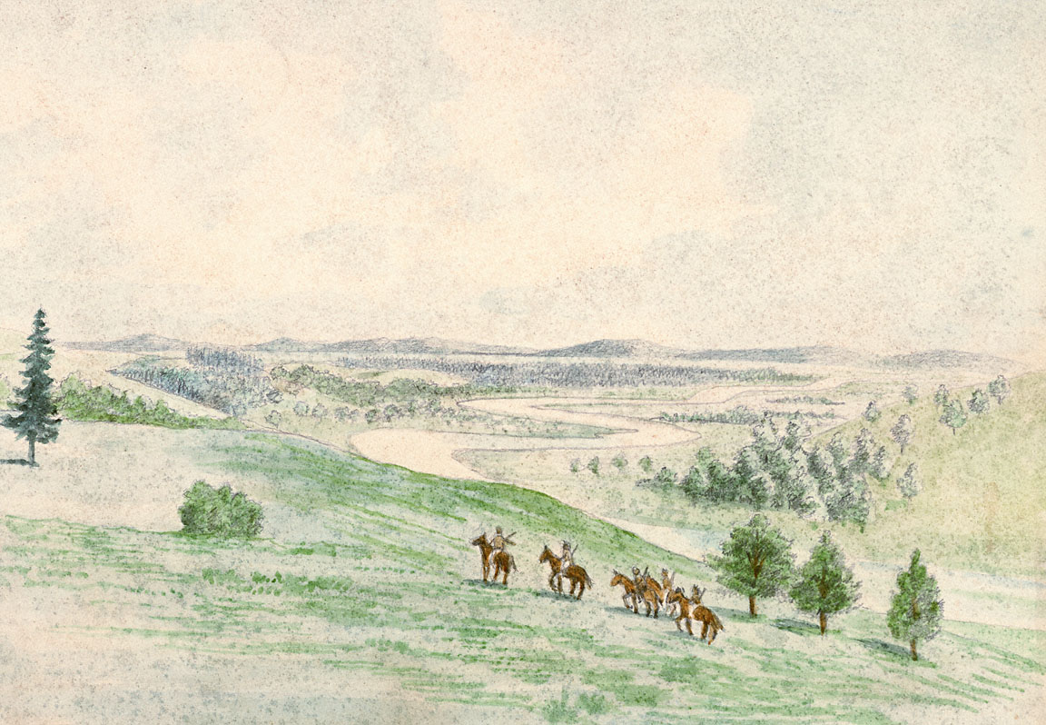
This landscape scene was sketched by Joseph Drayton in June 1841. Drayton was a member of the U.S. Exploring Expedition, an American naval expedition that explored the Pacific Ocean and Pacific Rim from 1838 to 1842.
Titled “Faulitz River from Yam Hills,” this sketch probably shows the Yamhill River as it meanders through the Yamhill Valley on its way to the Willamette. The landscape is quite open, with groves of oak and Douglas fir scattered across a matrix of prairie. This pattern of prairie and oak-fir savannah was common in the valleys of western Oregon and Washington prior to white settlement.
Scholars agree that this type of open landscape was formed and maintained by fire, but they disagree about what the primary sources of ignition were. A number of anthropologists and geographers have argued that intentional landscape burning by Native peoples was the most important factor in the establishment and maintenance of prairies and savannahs like those shown in the sketch above. They note that lightning is rare in western Oregon and argue that Native burning is the best explanation for the high frequency of landscape-scale fires in the western valleys prior to white settlement. Anthropologist Robert Boyd, for example, argues that “Indian use of fire in the Willamette Valley was so frequent and widespread that it maintained what ecologists would call a ‘fire climax’ biotype.”
This explanation is supported by a number of early written accounts. Scottish botanist David Douglas, for instance, noted that deer were scarce in the Yamhill River area in the fall of 1826 due to “the plains being burned by the Indians to compel these animals to seek food in certain parts more convenient for hunting.” Fifteen years later, members of the U.S. Exploring Expedition recorded one of the few eyewitness accounts of Indian landscape burning in western Oregon. While traveling south through the Rogue River Valley in September 1841, they encountered an Indian woman “blowing a brand to set fire to the woods.”
Not all scholars, however, are convinced that Indian burning is the best explanation for the open nature of western Oregon’s valleys. Geographers Cathy Whitlock and Margaret Knox examined tree-ring, pollen, and charcoal records and found that changes in vegetation and fire regimes during the last several thousand years in the Willamette Valley have been closely linked to changes in climate. They suggest natural factors are sufficient to explain prehistoric fire regimes, arguing that “prehistoric peoples locally altered the landscape, but there is no strong evidence that their activities created new vegetation types at a regional scale.”
Further Reading:
Boyd, Robert, ed. Indians, Fire, and the Land in the Pacific Northwest. Corvallis, Oreg., 1999.
Johannessen, Carl, et al. “The Vegetation of the Willamette Valley.” Annals of the Association of American Geographers 61, 1971: 286-306.
Vale, Thomas R., ed. Fire, Native Peoples, and the Natural Landscape. Washington, D.C., 2002.
Written by Cain Allen, © Oregon Historical Society, 2006.
