World War II and the Post-War Boom
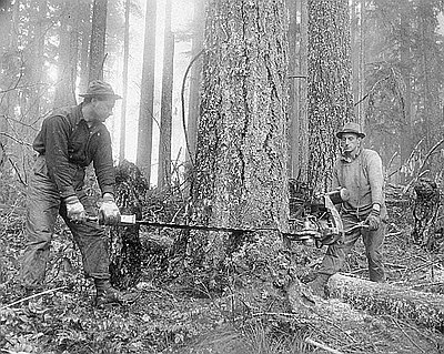
By 1940, with a war in full blaze elsewhere on the globe, the United States began to hum with global demand for its resources and manufacturing production. The economic boom accelerated as a result of the nation’s entry into the war in December 1941. Although Portland and other urban places in the Pacific Northwest became major manufacturing centers of the Home Front, southeastern Oregon’s main contribution to the war effort was an increased production of lumber and beef. High prices for these two commodities returned, and, even with wartime wage and price controls, steadily rose higher than anything the market had offered before. During and after the war years, the timberlands of the Warner Mountains and the western Lake County, tapped by Weyerhaueser railroad spurs running eastward from Klamath Falls, supported dozens of sawmills. Many of them were small-capacity, family-run operations, but with the demand for lumber, their profit margins were high.
Although sons and daughters left Lake, Harney, and Malheur Counties to join the armed forces or to work in the defense plants on the West Coast, and some of the area’s soldiers, sailors, and airmen died in the Pacific and European theaters, the military part of the war had little impact on southeastern Oregon. Several Army infantry divisions participated in the 1943 Oregon Maneuvers between Bend and Burns on the northwest margins of the High Desert. At Lakeview, a lightly used training airfield for Army Air Corps bombers was built.
Spurred on by both the pent-up consumer demand of the late Depression years and by the high wages of the war years, much of which went into savings, America’s postwar economy took off on a thirty-year-long trajectory of rising middle-class prosperity unheard of before or since. Southeastern Oregon participated in this postwar boom largely through increased commodity demand for beef and lumber. The Rural Electrification Administration (REA), a New Deal program, remained in business after the Depression. Together with the Bonneville Power Administration and the influence of local rancher Reub Long, the REA built a long line of power poles south and east from the Bend area, finally bringing electricity to Fort Rock and Silver Lake in 1955.
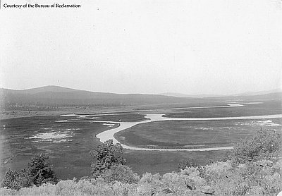
With improved water-pumping technology, the Columbia River-generated hydropower of the Bonneville Power Administration helped create another land boom in the northern Great Basin. The relatively shallow aquifer of groundwater, long hidden beneath the dry bed of Lake Fort Rock, could now be tapped by powerful pumps for large-scale irrigation, as well as for increased domestic use. During the late 1950s and through the 1960s, cultivable private land throughout the Fort Rock and Christmas Lake valleys turned emerald green with circles of alfalfa hay, watered with center-pivot pumps. Electrification eventually did the same in a few other groundwater-blessed parts of the region, making some of the High Desert bloom.
The federal government emerged as an important player in the postwar era. The Bureau of Land Management (BLM) became a dominant presence on the High Desert from the 1950s to the 1970s, managing the range and overseeing grazing on millions of acres of federal land. And it was during the 1970s that the BLM began its role in managing the region’s remnant herds of mustangs, the wild horses descended mainly from the great nineteenth-century ranches’ working horses.
Federal funds heavily bankrolled the construction of Highway 140, bringing a well-engineered, all-weather highway through southeastern Oregon. The Winnemucca-to-the-Sea Highway, as it was called, soon became an important shortcut for freight truckers and others traveling between western Oregon and points east. Also during the 1950s and 1960s, after the onset of the Atomic Age and the Cold War, the federal government subsidized the prospecting and mining of uranium deposits in the American West, including some near Lakeview.
© Jeff LaLande, 2005. Updated and revised, 2014.